|
|
Post by seenvic on Jan 22, 2017 15:26:24 GMT -5
Just like Jmyers I am also a local mountain biker who has frequented Boyd's Pond. I can say I have always had a love hate relationship with this trail. Boyd's Pond will definitely get you into shape and make you a better rider the more you ride it. I have noticed the last few times I have been out there, which is not quiet as much since I moved to North Augusta, the trail is getting some serious erosion problems. I have also been on some of the new trails that have been added and am like Jmyers when he says I just can't get into them. There is also a few new additions I do like as well though. I appreciate all the work that has been put into Boyd's and think it is great that it is getting the attention it finally deserves. I do see the need in some trail improvements, especially for the erosion problems. I also feel there is some parts of Boyd's that should never be messed with. I can still remember the first time I ever made it up the wood platform and it puts a smile on my face even now. I do think part of the Boyd's pond draw for some of the more seasoned riders is also what puts off some of the beginner to novice riders from coming to Boyd's. I would hope a compromise could be made so that Boyd's could be a good place for all riders to come and enjoy no matter what their skill level. Also if there is anyway possible for me to help with anything at Boyd's as long as I am able I will help. Horses were on the Main Trail sometime recently. Either today or yesterday based on the fresh piles I saw. That is the last thing Boyd Pond needs is horse traffic. Clown Corner is the signature section at Boyd and while I am not a fan of running trials along the bottoms of drains, it works at Boyd and Clown Corner (CC) is the best example of it I've ever seen in my life. The issue is the entrance to CC is not on park property. I'd say CC is actually the best trail work at Boyd Pond. High marks, especially for the crib wall and getting the trail out of the bottom of the drain. The wooden exit is cool, but think it could use hardware cloth on it. I'd like to keep all of CC until we are asked to get off the private property. I see a line that would get us exactly to the CC entrance by going just slightly off park property, but didn't flag it. I flagged another half a mile today. What I flagged today continued the Main Trail reroute and tied it into CC, removed all the out of bounds sections and used several sections of the existing Hero and Main Trail that will just need to be debermed. I do see clay 2-6 feet under the sand. You can see it in the deep erosion ruts in Kabooki and in the Clown Corner section where some bench cut work has been done. You can see the soil profile almost perfectly there, where the sand stops and the clay starts. We have to cut some bench on some steep sideslope in Boyd and very well could end up hitting that clay. I also see the Nature Trail is down to clay in alot of areas. Hero Trail sits on a hillside and spends it's time going up and down the fall line of that hill. I cross it alot. I get on a time or two where it doesn't go straight up the hill. Hero Trail doesn't surf any drains that I saw while flagging near it. But Four Logs Trail does surf drains. I hope to be able to flag into these drains and leave the drain surfing as an option for riders who like that. I never look to put trail running the lengths of drains so that may work great when I get over by that section. I'd like to start to build the Kabooki reroute as soon as anyone wants to work. No matter this has to be done and the route I have flagged is over the top. |
|
|
|
Post by seenvic on Jan 8, 2017 14:14:32 GMT -5
 Above is a picture of the second proposed reroute at Boyd Pond. I flagged this over the last two weekends. The first one we did at Mocassin Madness is much shorter and construction is almost completed. This reroute takes out ~900 feet of Main Trail going straight up and then straight down the same hill. This is the last climb up and the last descent down if going CCW. The last downhill is called "Kabooki" for folks familiar with the names of the trails. It uses parts of Hero Trail and takes out other parts of Hero Trail that constantly goes straight up and down the fall line. We cross Hero more than we use it....actually it crosses the existing trails alot and they will provide wonderful drainage for the new trails. Similar to when we redesigned the Long Cane Horse Trail - the old existing fall line trails were great to cross and use for drains. The new trail is ~.63 miles that carves and surfs these same hillsides. The climbing will remain challenging to riders, especially in the switchbacks. I fear these switchbacks may crush some people, actually. The new trail is almost 4 times longer and is an example of how much trail we can actually put at Boyd Pond. There is always more trail on the contours than doing up and down the fall lines. Always. More distance can be added to this reroute. The realist in me is concerned how we are going to build the .63 miles flagged now if dependent on volunteers only. There can be twice to three times as much trail at Boyd Pond as there is now if we can figure out to gather up the labor it will take to build the trails. Once we build them, there will be alot less erosion and continuing tread maintenance over time. Use will explode as people will actually like to ride the trails instead of it being a place that is sandy and perculates the water quickly thru the sandy soils. This will be very sweet trail to ride. You will love it if we can get it built. I was giddy flagging/mapping it. At one time I told y'all what the Old Tower Trail was going to become. And it became FATS. Here is what Boyd Pond can be in two-three years: -At least two times as many miles of trail than is there now. -Trails that will have flow, are challenging and not eroding as badly. -Trails that actually shed water off the low side, while still keeping the perculating traits the sandy trails at Boyd have now. -All hand built if people are willing to work AND we get a grant like we did at Hickory Knob and hire a hand crew. -Boyd Pond can be our race venue. Great facilities to host events. A pond for water events. Sandy soils that perculate the water better than any other location in our locale. There is hardly any clay in the soils at Boyd. I've seen a little on the Nature Trail - and it was a mucky mess in that spot today. -Full time dedicated training trail if Parks goes for that idea. -1-1.5 miles "beginners loop" that will be great for kids and beginners. |
|
|
|
Post by seenvic on Jun 13, 2016 15:33:08 GMT -5
Rode BP again. It's getting hot, and I got worked. But this is the place to ride for me. I love it and thank you to those who put it here.
I want to meet up with the people working there and ride and help out. Seriously. I really want to start to put some flags in the ground there and figure out a way to handbuild some proper bench cut without killing myself or any others in a very small group. I'd like to figure out a way to pay a crew to handbuild down there. It will take some time, but FATS wasn't built in a day.
Boyd Pond has to stay handbuilt.
Aiken County PRT has the right people to work with right now and as soon as it cools off in the fall, it's time to go. I moved to Aiken about a year ago, thus the sudden interest in Boyd Pond. There is also a nice new disc golf course across the street, so it's a one-two punch for me to go to Boyd Pond.
|
|
|
|
Post by seenvic on May 31, 2016 10:07:38 GMT -5
Did the majority of riders help us with FATS?
No.
Therefore, should we not have built it?
If the majority wanted to pave FATS, would that be ok?
The original line disappeared because MTBing is full of split second decisions that one makes without even thinking about. If you don't know or don't remember the original line, the alt line is so ingrained by the riders who rode it in that EVERY rider goes to it before he/she realizes "this is where that fun part is". This is not a hard concept to get for someone who rides.
|
|
|
|
Post by seenvic on May 29, 2016 20:45:21 GMT -5
I rode Boyd Pond for the first time today.
I had a blast on 90% of it and 10% .......I couldn't even believe on a couple levels.
It was like riding a modern bike on a something we'd ride back in the early 90s'. Not really a trail, but what we had to ride and we loved it.
I did have trouble finding where to start. Once someone told me to park across from the old golf course, it was smooth sailing.
Main Trail. Fun. Best part of the ride, no doubt. It is full of fall line, but damn it was challenging, fun, tight. Great old school rake n ride trail. I think there is a spot or two at the end that may need to be re-thought.
Four Logs of the Acropolis. No way this was done by the same person who did Main Trail. Saying someone is volunteering wrong is always bad form so I am not going to do that. I am willing to help dig, educate, whatever....But in the kindest way possible, Four Logs has some serious problems with flow, fun, fall line etc...It is not going to age as well as Main Trail especially if traffic on the trail system increases. Some of the stuff that made the least sense (to me) looked like it was a fairly easy fix. But it's still trail work and that is rarely "easy".
Pyscho Trail. Looked older than Four Logs, but doesn't get much use. Needs a little works. Needs wheels.
It looks like to me that some spots the trails goes where it goes because that was the easy place for it to go. But it isn't where it needs to go. I understand that bench cutting is bitch, and that place needs to stay hand built.
That is what I rode. Took my dog and she had a big time. I had a big time. Thanks to all who built it. I'll be back to ride and help out. I live 20 minutes from it and there is a really good disc golf course getting ready to open right across the street.
|
|
|
|
Post by seenvic on May 29, 2016 17:41:55 GMT -5
When we (not they, "we" as in me and other locals) first built FATS, that was maybe the only technical feature out there. The "ride arounds" started immediately. Every time I would stop, and block those lines. And everytime the line would be back open the next time I came thru. I was always amazed about a few things: 1. That people were stopping and getting off their bikes and reopening these ride arounds. And the stuff I would put there would get further and further away. 2. They didn't stop when we actually put a sign there designating where the trail was built. 3. I would loudly and proudly say I was the one blocking the ride around lines. 4. The person(s) who were getting off their bikes and making the ride arounds have never spoken out as to why they are doing this, are proud of it and why they should do it. Never. 5. I will go back out there and make that ridearound path unridable. That line is going back over those rocks. 6. I promise. On a much larger scale, but same issue. rootsrated.com/stories/save-the-pinhoti-trail-from-unauthorized-modifications |
|
|
|
Post by seenvic on Dec 20, 2015 14:06:38 GMT -5
Rode Modoc today, 12/20/15. Nice ride. Many trees that can be ridden over which is nice. Several I had to get off for mostly towards the end. Out of shape, but had fun. Throwing disc is the woods most of the time is not good cross training for riding :-)
Just needs wheels. Badly.
|
|
|
|
Post by seenvic on Sept 25, 2015 16:37:04 GMT -5
 This is what took me away from mountain biking. When I do ride, I enjoy it. But I find myself reaching for my bag of discs more than my 29er. When my kids are older, we will ride again because it will be something we can actually do together. But right now, I am playing the game of being a good dad. Riding slow in the woods waiting for kids is less fun than throwing off a tee, walking down a fairway with them, talking, then when it's my turn I can try as hard as I want. I can't ride as hard as I want with kids. And it turned out one of my kids is a natural at this game. And is now a World Champion and sponsored by Prodigy Discs. Prodigy is sending Ava 70 discs with this stamp on them. Crazy for a 10 year old, but she takes it in stride. Me, I full on brag about her. :-) Me....I am about the same spot in disc golf as I was on a bike. About mid pack. I do miss my friends from SORBA and how organized and professional SORBA CSRA is. The local disc golfers could learn alot from SORBA CSRA. The funny thing is they all do alot volunteer work maintaining the local courses. Same thing as MTBers with 5% do 95% of the work. I am not letting them know quite yet about my past and I've only been to one work day. |
|
|
|
Post by seenvic on Aug 6, 2015 15:24:12 GMT -5
El Patron on Washington Rd is actual Mexican food that local Mexicans eat.
It is unlike Teresa's, Valarta's, Mi Rancho, or any other "hot plate Mexican". White people eat at those places, but actual Mexican people do not eat at these places.
El Patron is the one. The food is good, authentic and you may be the only non-hispanic person eating there.
It is just outside I-20 across on the right if you are going towards Martinez/Evans.
|
|
|
|
Post by seenvic on Mar 16, 2015 15:23:22 GMT -5
I always wondered what people riding next to the armor thought was going to happen in the long run.
|
|
|
|
Post by seenvic on Feb 10, 2015 14:44:33 GMT -5
Best analogy I have is traffic.
When we are in alot of traffic, it would be fine if all the other cars simply were not around. It is difficult to see yourself as part of the problem because you are one car and the problem is so many cars.
FATS is the same.
If only a few riders showed up on less than ideal days, there would be no problems. But FATS is so popular that riders show up thinking it is just me and I don't do that much damage.
Same as the driver sitting in traffic.
|
|
|
|
Post by seenvic on Feb 9, 2015 10:53:27 GMT -5
Website says this. "FATS is too wet to ride. Please ride one of our old school trails - such as Keg Creek, Mistletoe, or Modoc. "
I drove past FATS yesterday and you literally couldn't get another car in the parking lot. It was like opening day.
|
|
|
|
Post by seenvic on Feb 2, 2015 18:24:01 GMT -5
Those are some good rides you are doing. Thank you for the pics and words.
There is a bridge at the very northern tip of the Long Cane Ranger District. It is not too far from "Buelah Baptist Church" and the LCHT. In 1998 me and fella from Aiken who is still around but out of the MTB scene got dropped off at his bridge and rode to Baker Creek State Park that day. We took parts of the LCHT and actually ate under the "Largest Shagbark Hickory in the US". It was the first time I'd ever been there, and I was completely lost. Funny because now I know that area very well. We rode Baker Creek to Modoc the next day (via Plum Branch Trail, and then the Connector Wine - Turkey - Modoc). We rode from Modoc to the "Tower" the next day and then home to North Augusta. We had no cell phone and a really crude map. We spent a good chunk of that first day lost. Our lives were probably saved by Ester Thrillkill, who may have had 5 teeth. But it was the water bottles she had that saved us. That ride became the Long Cane Massacre Ride the next year, in the fall of 1999.
A fella I knew named Bruce Norris used to do these long gravel grinders. He showed me the loop around Turkey/Wine that I see re-posted on here from time to time (usually by Brian W and good on him for posting it). About a month after I told Bruce we rode 140 miles in 3 days and covered the whole district and rode all the available single along the way....Bruce did an 80 miler in a day that avoided all the single but covered the whole district in a day. Bruce died a few years ago and never shared that exact route with me, but it wouldn't be difficult to come up with one.
I need to go ride.
|
|
|
|
Post by seenvic on Dec 16, 2014 12:07:56 GMT -5
I am planning to make this ride.
I know the route and will probably be the slowest rider. It may be my 4th ride or so of the last 2ish years. I hope got 25 miles in these legs still.
So you may have a good sweeper for this one.
|
|
|
|
Post by seenvic on Dec 9, 2014 12:27:44 GMT -5
The Columbia County Convention and Visitors Bureau has generously donated two entries for the 2015 Wildwood Games that we will give away to two deserving volunteers. These entries are good for any sport including the trail run, swim, disc golf, or, wait for it…the USA Cycling Marathon Mountain Bike Championships. Who doesn’t want to ride with the pros? 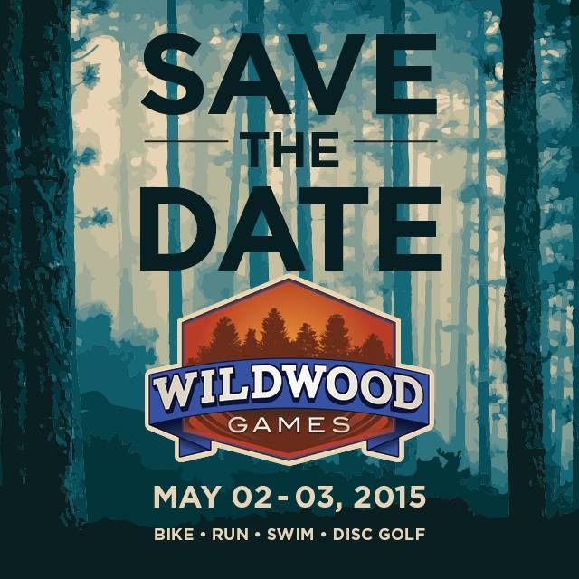 Thank you Randy DuTeau for supporting SORBA-CSRA volunteers with this great opportunity to participate in the WW Games next year. If I don't go the KY Derby that weekend, I'll be in that Disc Golf Tournament! My how things have changed! |
|
|
|
Post by seenvic on Nov 16, 2014 21:21:09 GMT -5
I was once President of this chapter. It was a long time ago. I can't recall much I did, but no doubt the best move I made was picking Angela Allen to be the President after me.
That was a great post.
|
|
|
|
Post by seenvic on Nov 14, 2014 11:03:43 GMT -5
Sorry to hear the incident occurred and escalated to the level it did.
I know both guys and find it unfortunate.
If I am guessing right, you were probably standing "in the way on the rocks" because you never see anyone ride that line over the rocks. Hence you stood where you thought the rider would not be going. That is best I can figure for having not been there.
The last time I rode FATS I got to this point and didn't even know where I was. I knew we didn't build a line below those rocks. I was behind another rider who isn't local, and he came to a stop and so did I. I recall saying "where are we", and then realized to a great level of disappointment that our flow over the line on the rocks was ruined by the most obvious line my out of friend saw but wasn't sure where to ride.
And that is the problem with multiple lines. They always migrate to the easier line and riders don't see anything but the easy line and difficult line goes away.
|
|
|
|
Post by seenvic on Nov 14, 2014 10:46:48 GMT -5
Marco is over 50! You want his number?
|
|
|
|
Post by seenvic on Nov 14, 2014 10:34:29 GMT -5
I would also like SORBA input to the correct line of that feature because I to like to attempt the rocks because it is a challenge but also honor SORBA work they have done and so which is the correct line around the rocks over the rocks or either. I would hope either but will Honor your decision Also we cleared the trail for either route for said marco but he didn't fare to well so he thought he would take it out on us. The real line is over the rocks. That is where the trail was built. The sign saying "stay on the trail" was put there before the new line below the rocks was formed by riders who took upon themselves to create a line they could ride because they didn't have the ability to ride the rock line. SORBA did not build the line below or above the rocks. If your description of Marco's behavior is accurate, he was out of line. I walk things all the time I don't have the ability to ride. Others should too. |
|
|
|
Post by seenvic on Oct 23, 2014 17:42:44 GMT -5
Rode FATS today for the first time in maybe a year.
Nice out there.
First time I've seen it since the ice storm...looks different.
I rode Skinny and Brown Wave.
But overall, it was just like riding a bike. Ya never forget how.
|
|


