|
|
Post by kconner on Jun 21, 2013 10:08:04 GMT -5
|
|
|
|
Post by kconner on Jun 18, 2013 19:26:18 GMT -5
Looking forward to this year's write up! Last year sounded so fun that I may drive up there and camp just to watch  You should come, we can lock out your gears to turn your bike into a defacto SS for $0. It's a crazy good time. I've still got the converted 26er....bad thing is that it's heavier than my 29er lol. I haven't jumped on the SS much (haven't ridden much at all lately, thanks Mother Nature), but that may be fun to do the cross country race if I get time to ride the SS before then. I've got the weekend off, I think it would be fun just to go hang out and watch |
|
|
|
Post by kconner on Jun 17, 2013 21:06:31 GMT -5
Looking forward to this year's write up! Last year sounded so fun that I may drive up there and camp just to watch |
|
|
|
Post by kconner on Jun 16, 2013 10:23:12 GMT -5
One last question...is there cell service up at bartram...just curious? Yes....there may be one or two bad spots, but if there is they are few and far between. |
|
|
|
Post by kconner on Jun 8, 2013 19:50:41 GMT -5
Any more information about the workparty? I'm off the last weekend of the month, but was curious if a specific day has been picked yet....
|
|
|
|
Post by kconner on Jun 7, 2013 22:25:12 GMT -5
Had this video (made by IMBA) sent to me by a friend: If you're looking to do a quick, relatively close MTB trip, Coldwater Mountain should be on your very short list! |
|
|
|
Post by kconner on May 31, 2013 16:14:36 GMT -5
It sounds like FATS would be right up your alley. It's an IMBA epic which is cool, and six loops gives you lots of options for lots of miles if you feel froggy, but you can also cut it down to one or two loops if you're into a nice easy laid back ride. Not much in the way of technical features, but just enough elevation change to get a good cardio workout. Nice buff singletrack with tons of flow, but watch your speed, it's easy to get in over your head and have a mishap.
Check the SORBACSRA home page for current weather conditions.
Lots of other places to ride, but if I only had one day to ride, FATS is where I'd go.
|
|
|
|
Post by kconner on Apr 27, 2013 13:21:49 GMT -5
Sherri and I walked the dogs out there last night. Couple of observations: a section had been burned (earlier in the day?) and was still smoldering. This was directly across the water from the main parking lot. There was a narrow fire break around the perimeter. One small hotspot up the hill from the trail was still burning and the smoke was very heavy. There were some 4 wheeler tracks past the burned area and I'm guessing that they were from the fire response folks. We walked for a couple of miles (counter-clockwise)and I'm happy to report that we did not come across any additional fires. Also, we noticed that someone is already messing with the mile markers (the "26" had been removed from the last one.) We turned around just past the mistletoe spur trail so I can't comment on conditions past that point. There was a woods fire (not a prescribed burn) somewhere in that area yesterday afternoon. Not sure what started it, but the local fire department and GA Forestry had a tractor and a couple of woods trucks in the area. As long as any hotspots are in the plowed area, there shouldn't be anything to worry about as far as the fire is concerned. |
|
|
|
Post by kconner on Apr 27, 2013 13:18:01 GMT -5
Sherri and I walked the dogs out there last night. Couple of observations: a section had been burned (earlier in the day?) and was still smoldering. This was directly across the water from the main parking lot. There was a narrow fire break around the perimeter. One small hotspot up the hill from the trail was still burning and the smoke was very heavy. There were some 4 wheeler tracks past the burned area and I'm guessing that they were from the fire response folks. We walked for a couple of miles (counter-clockwise)and I'm happy to report that we did not come across any additional fires. Also, we noticed that someone is already messing with the mile markers (the "26" had been removed from the last one.) We turned around just past the mistletoe spur trail so I can't comment on conditions past that point. There was a woods fire (n |
|
|
|
Post by kconner on Apr 12, 2013 20:36:02 GMT -5
|
|
|
|
Post by kconner on Mar 19, 2013 13:11:42 GMT -5
An email was recently sent out to the current members of the NMBP. If you didn't get this email, let us know so that we can get you added to the list or get you current email address updated.
There are two events coming up that the NMBP has been requested to help with:
First is the Best Dam Ride on Sunday, April 21, starting at 8:00 am. The NMBP is being requested to ride the mountain bike portion, which starts at Below Dam Park, up to Bartram Trail to Wildwood Park.
Second is The Lock to Lock Ride on Sunday, May 19, starting at 2:00 pm. The NMBP is being requested to ride the route, which begins at the Savannah Rapids Pavilion, goes to Lock and Dam Park (by the airport) and back.
If anybody is interested in helping out with these events, email us at nmbp.sorba.csra@gmail.com and we will keep you informed as we get more details.
Finally, if anybody needs a CPR card (either new or a re-cert), let me know, along with the date that the current card expires. We hope to have a CPR class at the same time as the NMBP class, but may also have a separate re-cert class depending on demand.
Happy Trails!
|
|
|
|
Post by kconner on Mar 19, 2013 12:56:55 GMT -5
Just a reminder for anybody that is interested in helping out with the NMBP....we are looking to boost membership in the local NMBP and are going to have a class shortly (date TBA). If you are interested, send us an email at nmbp.sorba.csra@gmail.com!
|
|
|
|
Post by kconner on Mar 13, 2013 12:16:28 GMT -5
This is one of our favorite places to hike in the area. Great wildflowers and there's a funky VERY old cedar tree you have to bushwack a little ways from the trail to get to but it's a hoot to climb. We usually eat a snack while sitting in the tree. I know, it's kinda silly. Thanks for posting these pics! Love seeing the little guy out on the trails. I think I know where this tree is. There is an entire grove of cedar trees just off this trail. I have never seen so many, large, mature cedars in one place. Years ago I was hired to redesign that trail and we flagged it right thru this cedar grove. But SCDNR wouldn't let us put the trail there as it went thru some other endangered plant species on the way to the cedars. I think the cedars are perhaps the most impressive thing on the site and it is a shame the trail bypasses them. What's the best way to get to this spot? I've heard of this spot before, but I've been unable to locate it in the past... |
|
|
|
Post by kconner on Mar 10, 2013 18:17:59 GMT -5
Modoc is in good shape. It looks as if something has gone in and fluffed up the leaves/pinestraw on the trail (turkeys maybe?) which can slow you down, but no big deal. Removed 4-5 small trees that were in the way with a hand saw, but there are 3 trees down that need a chainsaw. The same BIG one that Ted S. mentioned at mile 2.5, and one located around mile 3.5, and another around mile 4.5.
|
|
|
|
Post by kconner on Mar 10, 2013 18:12:42 GMT -5
Would the CPR/first aid be open for renewal for folks that have gone through NMBP class before? Brian, We would like to hold a CPR/CPR recert at the same time as the NMBP class, but that depends on how many are interested in the class, and how many need either the full class or the recert. I hope to have an email out to the current members sometime tonight or tomorrow to get an idea about CPR certifications and such. Stay tuned! |
|
|
|
Post by kconner on Mar 7, 2013 17:02:57 GMT -5
I was planning on riding somewhere today, but the wife was called in to work, and then I had baby sitting duties for the day. No matter, we'll load up and go for a hike instead! Haven't been to Stevens Creek Heritage Preserve lately, so we decided to check it out. It's nice out there right now, it's dry and no leaves on the trees means some awesome views! It's also got some elevation change, which gives a decent workout. I guess hikers need some trail education every now and then too.... 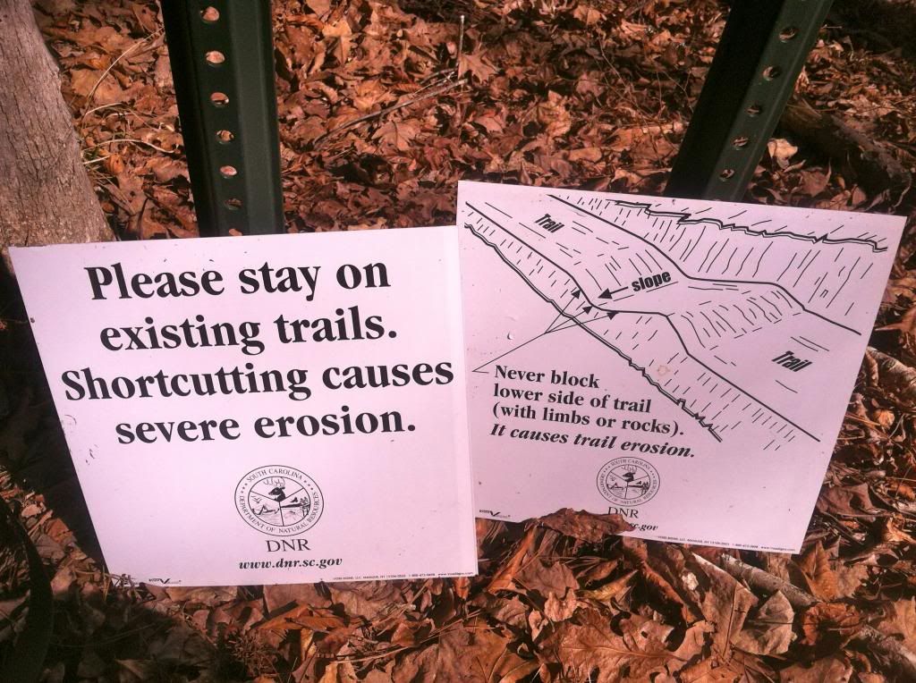 Lots of rocks 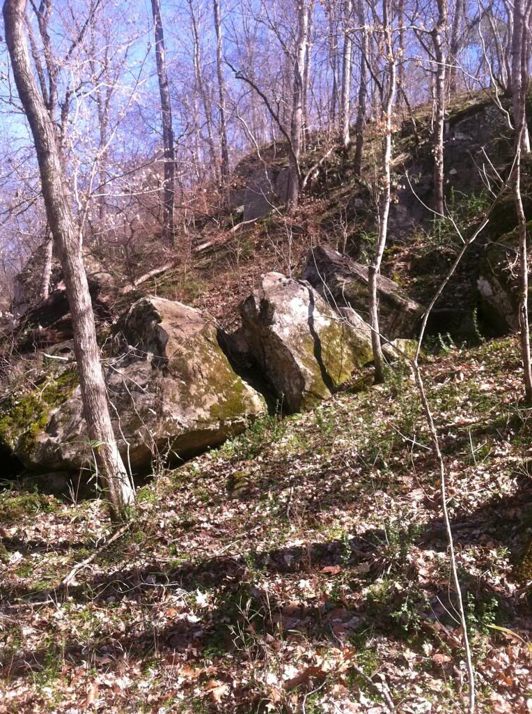 Sadie the trail dog leading the way 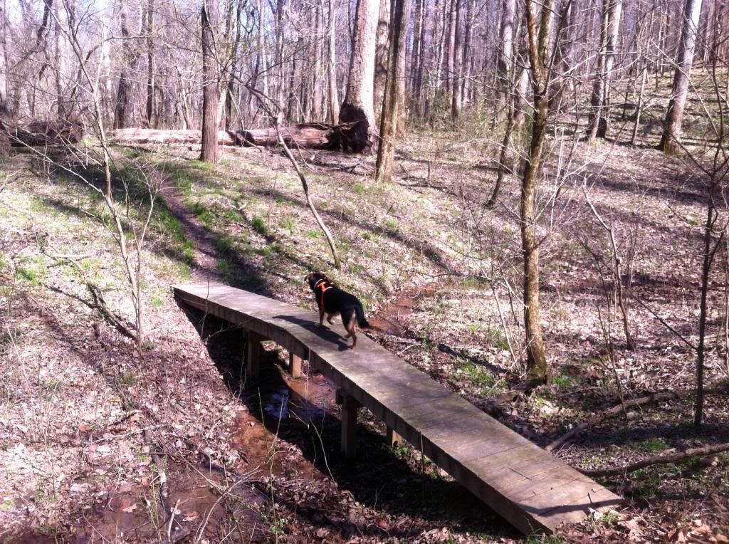 And up the old road bed  Luke's first hike! 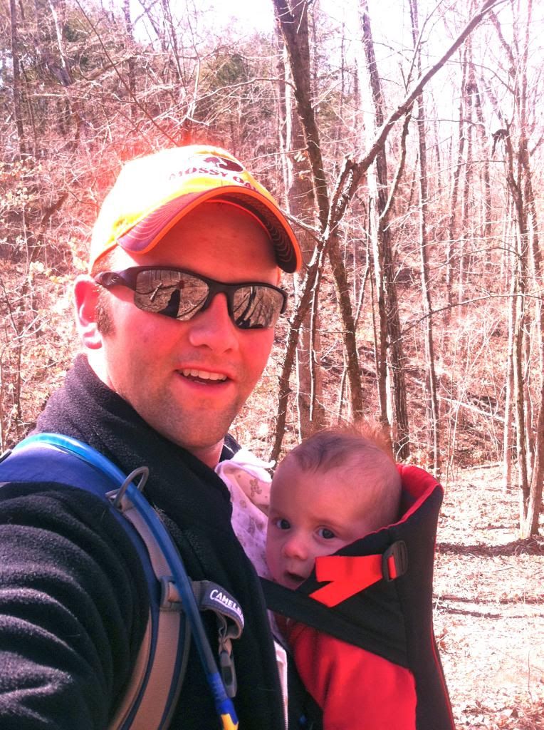 Along the ridge 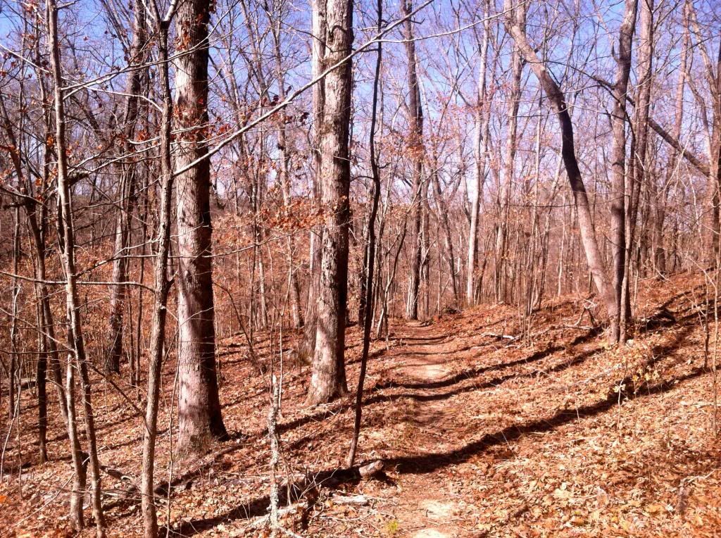 At the overlook 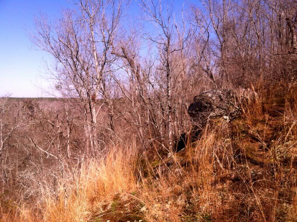 Again 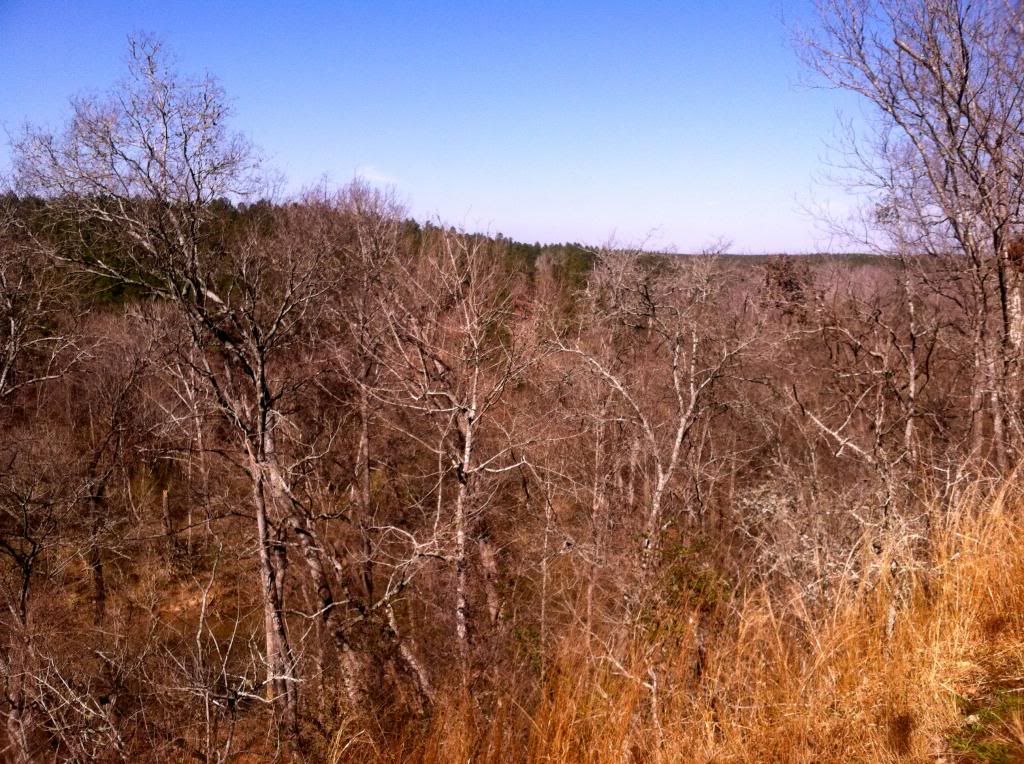 Weird tree 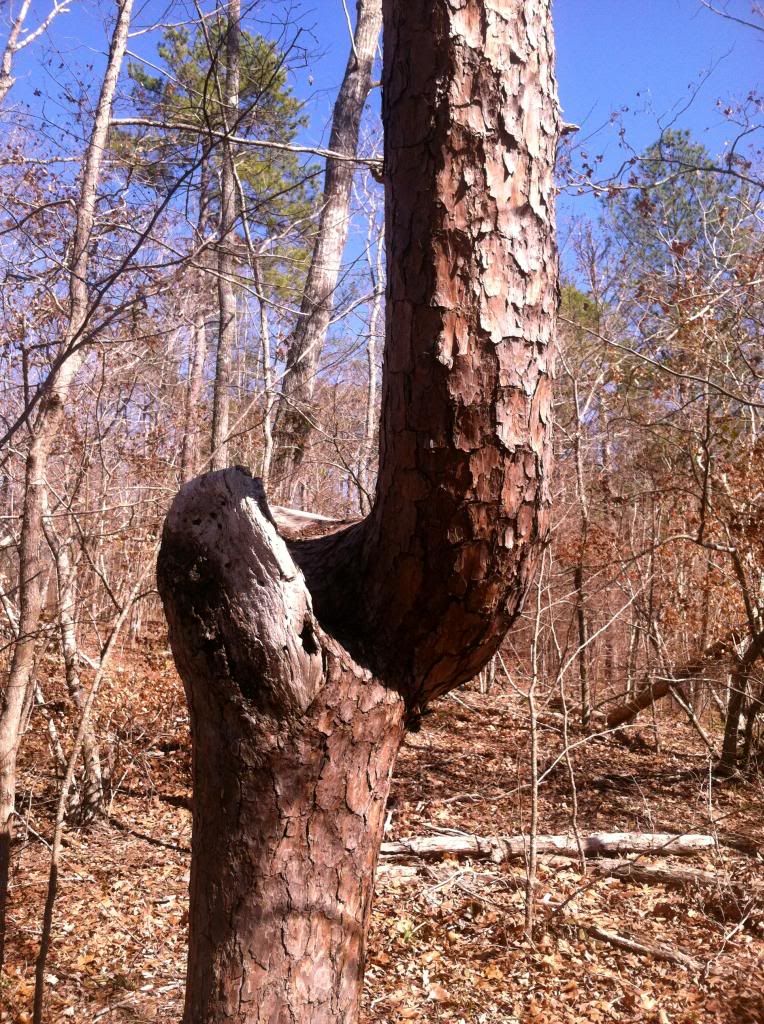 |
|
|
|
Post by kconner on Mar 7, 2013 16:08:37 GMT -5
Drove down Hopewell Church Road/Deep Step Road today and noticed they burned the north side of the road, roughly from Hwy 28 to roughly where FS 660E (the road to Furys Ferry Boat Ramp) comes out. They were also doing burns today, one down FS660E by the boat ramp, and another further up Hwy 28 on the river side of the road. Didn't look like any of these prescribed burns would affect any trails.
|
|
|
|
Post by kconner on Feb 15, 2013 14:52:03 GMT -5
I've been planning a MTB trip to Augusta with some friends for this weekend and just saw this. We figured that things would have dried out with more than 48 hours of dry conditions. FATS is the main attraction but we were also planning to ride Hickory Knob and/or Bartram on Sunday. Do either of those trails (Hickory Knob or Bartram) dry out faster than FATS? If so, do you think we could switch up the order and ride FATS on Sunday? None of us want to do trail damage but we've been looking forward to this trip for a while now and will need to cancel our hotel today if FATS is soupy all weekend. Anyone actually been on the property recently to check the trails? Also, can someone please clarify if blaze orange is still required at this time of year for midday riding? FATS still needs time to dry out....rode by on the way home from a gravel ride and saw a guy covered head to toe in mud....seriously, his entire body was mud colored and matched his bike. There are sections of gravel roads that are still holding water, so I doubt FATS will be anywhere near dry enough to ride before next week. Not quite sure about Hickory Knob and Bartram though. |
|
|
|
Post by kconner on Feb 5, 2013 21:05:55 GMT -5
Rode Great Wall this evening. One tree down 1 mile from the trailhead (CCW) in the first switchback. Turned around shortly after the tree due to lots of mushy spots. They should harden up by the end of the day tomorrow.
|
|
|
|
Post by kconner on Feb 4, 2013 9:44:20 GMT -5
Woo-hoo, it's almost MLTT time! The race is THIS Friday night, hope to see lots of folks out there, and can't wait to see what sort of costumes we get! I'll be rolling out of AJBW to the trail sometime between 4:30-5:00 to go mark the course and get the fire going. I wouldn't mind a hand if anyone else is free. I can meet you about then and help out. Would you like me to meet you at the trailhead or at AJBW? |
|