|
|
Post by kconner on Jul 13, 2011 21:34:18 GMT -5
sadly, im unable to make this work party, i'll be out of town. work parties always get scheduled when im working or out of town  Not true! You made the New Bartram work party for armoring that deep gully. MD that's true, and I had a good time! It just seems that every time a work party is scheduled, I'm working....if anybody wants/needs a hand for an informal work party, send me a message, I'd be glad to help out! |
|
|
|
Post by kconner on Jul 13, 2011 14:40:04 GMT -5
sadly, im unable to make this work party, i'll be out of town. work parties always get scheduled when im working or out of town |
|
|
|
Post by kconner on Jul 13, 2011 14:38:53 GMT -5
looking forward to this ride, should be able to make it  |
|
|
|
Post by kconner on Jul 6, 2011 13:24:03 GMT -5
It's awesome to get a little history lesson as well as a fun game from these pics.  +1....I really enjoy seeing the older pictures of the trails, it's neat to see how the trails began, especially for someone new to the sport like me Too bad some of the "funner" features are being lost like they are. I'll definitely be looking for that rock next time out. |
|
|
|
Post by kconner on Jul 6, 2011 8:52:03 GMT -5
Here is the next one. One of SORBA's founders (not SORBA CSRA, SORBA) has his back to you and the "mouth of the south" is holding up a tool. And one of our more lovely locals on the left. Those are Shrimper's kids riding. These are the first wheels this freshly armored section ever got.  appears to be Great Wall, photographer looking CCW, at one of the short rock gardens. I don't remember the rocks being that big, but another short rock garden appears to be in the back ground, right after turning right. |
|
|
|
Post by kconner on Jul 6, 2011 8:48:27 GMT -5
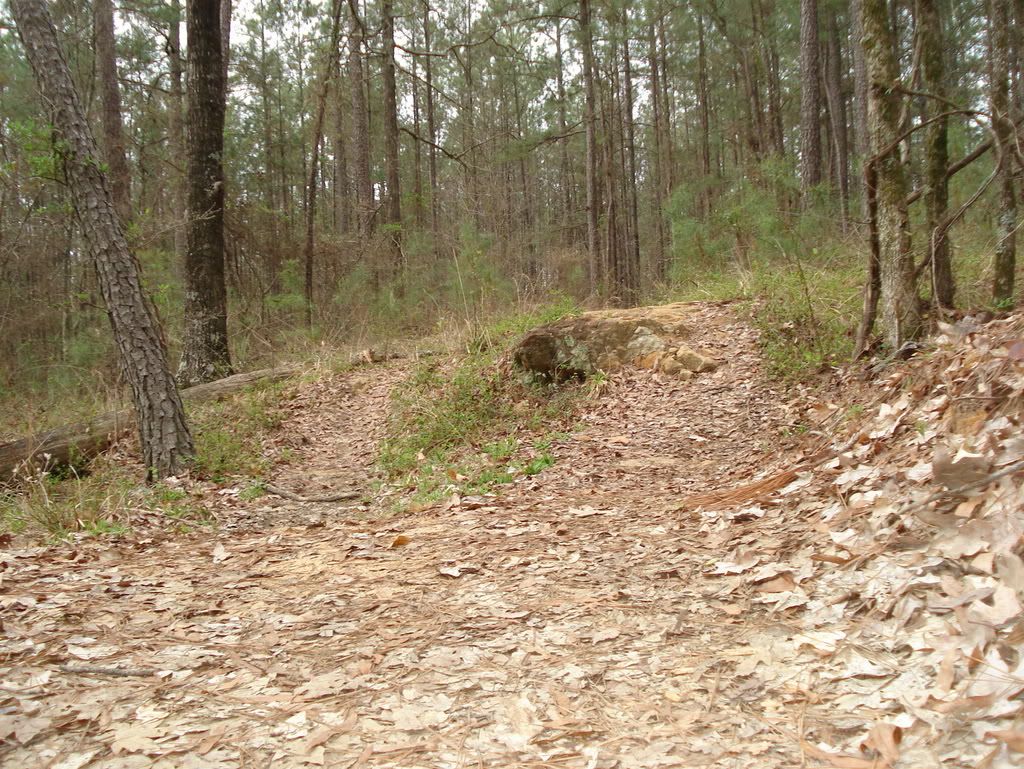
I believe this is the same rock you're talking about (in Doug's post). If so, the line to the left in this picture would be the ride-around, the line to the right would be the designed line, and down the middle would be the designed jump. Assuming this is correct, the jump line is still viable, just not easy to see. One can easily roll over the rock at an easy pace and their weight back on the bike, or one can also easily jump it if traveling at a decent pace. |
|
|
|
Post by kconner on Jul 6, 2011 5:28:22 GMT -5
Is that the rock on GW if going CCW there should be a major jump line there (was when we built it, but it never got ridden and died). gotta look for that line. +1. Assuming it's not the rock just after the tight and twisty section travelling CCW, where exactly would this jump be? Shame that some of these features have faded into the environment.... |
|
|
|
Post by kconner on Jun 29, 2011 20:59:36 GMT -5
Do we REALLY have that many low rent d-bags that we can't keep them in check? YES. It's a shame that they wreck anything good for the city and surrounding area. |
|
|
|
Post by kconner on Jun 29, 2011 18:42:31 GMT -5
We used to park in Eisenhower Park (near the ball fields) and come across that weird bridge to ride the canal when we didn't want to ride the dirt washboard down to the pumping station parking lot. Is that still available? last time I was down there people were using it. I stopped parking at Eisenhower Park when they had a rash of car break ins....I would be careful using that lot (even though the Lake Olmstead lot probably isnt much better) |
|
|
|
Post by kconner on Jun 29, 2011 8:47:48 GMT -5
Looks like the turn right before a bridge on west side of the Bartram Trail. Correct! |
|
|
|
Post by kconner on Jun 28, 2011 19:29:34 GMT -5
there is a bridge/boardwalk/creek crossing almost immediately behind me (it's been a couple of months since I've ridden this trail, pretty sure it's a bridge, but I'm not 100% sure)....care to name the trail?
|
|
|
|
Post by kconner on Jun 28, 2011 19:25:50 GMT -5
I've done that ride actually. Headgates to the marina and back. I think I followed the canal down to 13th street, then rode up the street towards the river and take a right at the bridge, there's a sign and a path on the leve, eventually merges into the river walk and you can follow it all the way to one of the marinas. Pretty long ride as an out and back....want to say I ended up with around 30 miles, give or take a few. click on the link, then click on the Augusta Canal map for a map of the entire canal/downtown trail system |
|
|
|
Post by kconner on Jun 28, 2011 12:09:48 GMT -5
The City of Augusta has maps online that refer to a "new" trail extension off the canal as New Bartram Trail. Unsure if this is what you're talking about, but this section has been around for years and doesn't see much traffic. There isn't any signage that I know of on the trail and it is currently waiting for funding for bridges to complete the extension. It can be accessed from Goodrich Street on the right (coming from downtown), just before bearing left and crossing over the railroad tracks by the aqueduct. It crosses under Riverwatch Pkwy. and then follows Riverwatch before ending in the woods at one of the mills' tailrace. Not really worth riding at the present time, as it can be somewhat sketchy in addition to being wide and flat.
|
|
|
|
Post by kconner on Jun 28, 2011 7:49:42 GMT -5
Only ridden Wine once, but thoroughly enjoyed it, except for the stinging nettles and the part where I endoed and possibly separated my shoulder My favorite part is the rocky section next to the creek  Let's try this one: 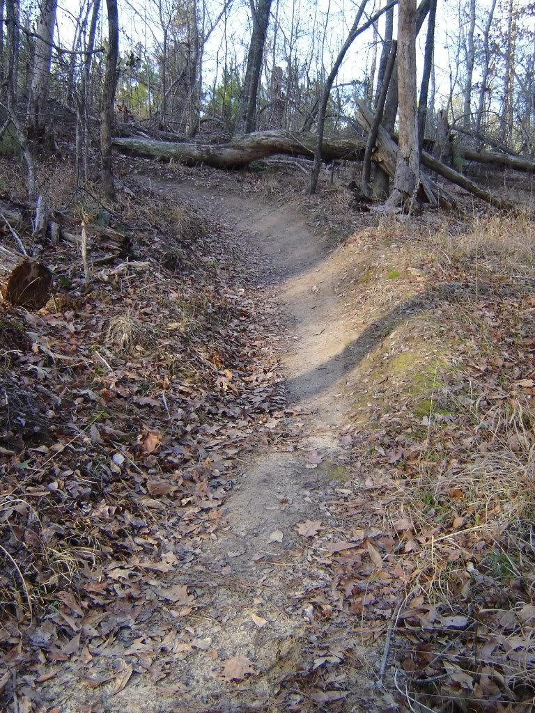 |
|
|
|
Post by kconner on Jun 27, 2011 22:07:41 GMT -5
wine creek, at the 283 trailhead?
|
|
|
|
Post by kconner on Jun 25, 2011 21:23:34 GMT -5
would love to come help, regrettably I will be out of town....
|
|
|
|
Post by kconner on Jun 25, 2011 21:19:47 GMT -5
I knew about the Saturday and Sunday events out at the fort along with the time trials at the dam, but was unable to make any of them. Wish this event would have been better advertised, looks like it would have been fun to watch.
|
|
|
|
Post by kconner on Jun 22, 2011 11:55:30 GMT -5
Rode Great Wall today, and the tread is in great shape. Tread was damp, but no places holding water. 2 trees down, one between the first and second set of rock gardens traveling CCW and is a trunk and canopy that is covering about 30' of the trail. A substantial ride around has already formed. Second tree is down between the halfway and 3/4 mark traveling CCW and is a canopy about 5' off the ground with branches hanging down to the tread. Riders can easily walk through without leaving the trail, but it should probably be removed for safety reasons. Also be on the lookout for sticks, they're everywhere and one took out my derailleur hanger |
|
|
|
Post by kconner on Jun 16, 2011 9:28:22 GMT -5
nice video, the contour has a good quality picture.
+1 on the bar mount. it's all i've got right now for my gopro, but i'll be changing to the helmet mount shortly.
|
|
|
|
Post by kconner on Jun 13, 2011 20:48:34 GMT -5
that's a good one!  seriously though, hope the rider is okay, lots of things can go wrong with a wound like that. just curious, does anybody know what happened to cause the crash? |
|


 seriously though, hope the rider is okay, lots of things can go wrong with a wound like that.