|
|
Post by dgaddis1 on Mar 19, 2015 12:03:02 GMT -5
|
|
|
|
Post by dgaddis1 on Mar 18, 2015 8:04:51 GMT -5
I'll be riding the Thurmond Epic this Saturday. Ride will start at Petersburg at 8am. We'll go east first to West Dam and back, pit stop at the cars to top off bottles/packs/etc, then off to Keg/Mistletoe. Things to keep in mind: -Big Boy & Girl Rules - you are responsible for yourself, bring food, water, and a map if you don't know the route. -Ride Your Own Pace - this is NOT a no-drop group ride. If you're fast, you don't have to wait on anyone. If you're slow, don't expect anyone to wait on you. Fire away with questions. This is all weather permitting of course. |
|
|
|
Post by dgaddis1 on Mar 15, 2015 20:29:51 GMT -5
|
|
|
|
Post by dgaddis1 on Feb 23, 2015 19:05:43 GMT -5
Wheels are sold.
|
|
|
|
Post by dgaddis1 on Feb 20, 2015 8:10:06 GMT -5
I recently added Bitex hubs to my product range, but before doing so I wanted to put my hands on a set to check on quality and whatnot first hand instead of just relying on internet reviews. They are shockingly nice for the price! So I went ahead and built a set up for promotional purposes (read more about them HERE) and now I need to move the wheels. These are new and never ridden. Stats: HUBS: Bitex (FAF12 up front, RAR12 rear) RIMS: DT Swiss RR440 (asymmetric rear) SPOKES: DT Revolution, 24H front, 28H rear, two-cross all around NIPPLES: Alloy COLORWAY: Johnny Cash WEIGHT: 1,462g Normal price would be $570 shipped, I'm letting this set go for $425 shipped or local pickup. Rims are tubeless ready FYI. Hub is 11spd Shimano, spacer included for 10spd use. SouthernWheelworks at gmail dot com if you want 'em or have questions.    |
|
|
|
Post by dgaddis1 on Feb 18, 2015 8:27:23 GMT -5
****UPDATE - CANCELED****Sadly, due to weather, trail conditions, and scheduling conflicts this year's MLTT is being canceled. Sorry. ******************************************************************** Andy Jordan's Bicycle Warehouse is putting on the 6th annual Moonlight Time Trails!!!!!!! WHEN: February 26th (Thursday) WHERE: Augusta Canal Singletrack - meet at the main trailhead at the base of the stairs WHAT TIME: Registration starts at 6:30pm, first racer off the line at 7:00pm HOW MUCH: $2 WHY: Fun in the dark It's that time of year again - MLTT time! One date again this year, and again we’ll do two laps, one each direction. Times will be added together to determine the winners. We’ll provide the bonfire and marshmallows, you bring your own beverage. Costumes:If you wear a costume you get a time bonus! More creative/elaborate costumes earn more of a time bonus. You gotta commit though and put some real effort into it, if we feel your costume doesn’t cut it, you get no time bonus, and end up looking goofy for no reason. Lights are required this year. Don't have a light? AJBW has a few demo sets, get in touch with them to reserve one. Rain plan: if there's lots of rain before the race it will be postponed to another date. The announcement will be made on this thread at the very top. This is a laid back race, catering to everyone and anyone that rides a knobby tired bike, not just hardcore racers. It's really just an excuse to ride and hang out. It’s family friendly, so feel free to bring the kids and the dog. Come check it out, it’s a ton of fun. Guaranteed! Any questions? 2014 info here2013 info here2012 info herePics from 2011 here, and last 2011 times here. 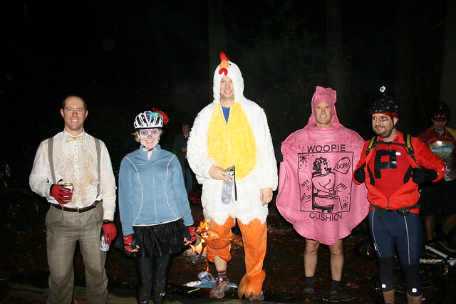 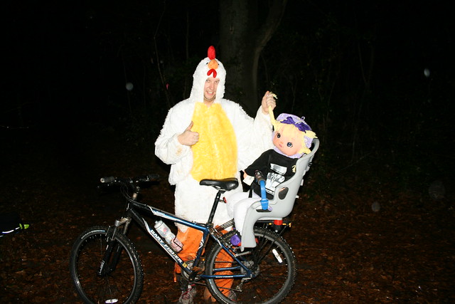
|
|
|
|
Post by dgaddis1 on Feb 9, 2015 15:07:14 GMT -5
Is there a place to get water in mistletoe st pk? Will i pass an spigot iut there in the thurmond epic? There's a water fountain outside the main office that is always available, even if the office is closed. Only potential issue is if they shut it off for freeze protection, but I've never ran across it turned off. |
|
|
|
Post by dgaddis1 on Feb 3, 2015 8:04:25 GMT -5
Those are some good rides you are doing. Thank you for the pics and words. There is a bridge at the very northern tip of the Long Cane Ranger District. It is not too far from "Buelah Baptist Church" and the LCHT. In 1998 me and fella from Aiken who is still around but out of the MTB scene got dropped off at his bridge and rode to Baker Creek State Park that day. We took parts of the LCHT and actually ate under the "Largest Shagbark Hickory in the US". It was the first time I'd ever been there, and I was completely lost. Funny because now I know that area very well. We rode Baker Creek to Modoc the next day (via Plum Branch Trail, and then the Connector Wine - Turkey - Modoc). We rode from Modoc to the "Tower" the next day and then home to North Augusta. We had no cell phone and a really crude map. We spent a good chunk of that first day lost. Our lives were probably saved by Ester Thrillkill, who may have had 5 teeth. But it was the water bottles she had that saved us. That ride became the Long Cane Massacre Ride the next year, in the fall of 1999. A fella I knew named Bruce Norris used to do these long gravel grinders. He showed me the loop around Turkey/Wine that I see re-posted on here from time to time (usually by Brian W and good on him for posting it). About a month after I told Bruce we rode 140 miles in 3 days and covered the whole district and rode all the available single along the way....Bruce did an 80 miler in a day that avoided all the single but covered the whole district in a day. Bruce died a few years ago and never shared that exact route with me, but it wouldn't be difficult to come up with one. I need to go ride. Keith, Trent, and myself are talking of doing a bikepacking gravel ride in March. Trying to cover the whole SNF is definitely something I had in mind for a route, though we haven't figured out specifics yet. We've event talked about doing a one-way ride. Who wants to volunteer to shuttle us to the start?? |
|
|
|
Post by dgaddis1 on Feb 2, 2015 15:35:11 GMT -5
Went out with the goal of doing 100 miles on Saturday, didn't work out. Kept hitting private property and had to detour around it, and was worried about running out of light, so I cut it short. Still got 65 miles, but not as much as I wanted. Took my road/commuter bike with 28mm slicks, which worked great. Google Maps cannot be trusted all the time. Good dirt. 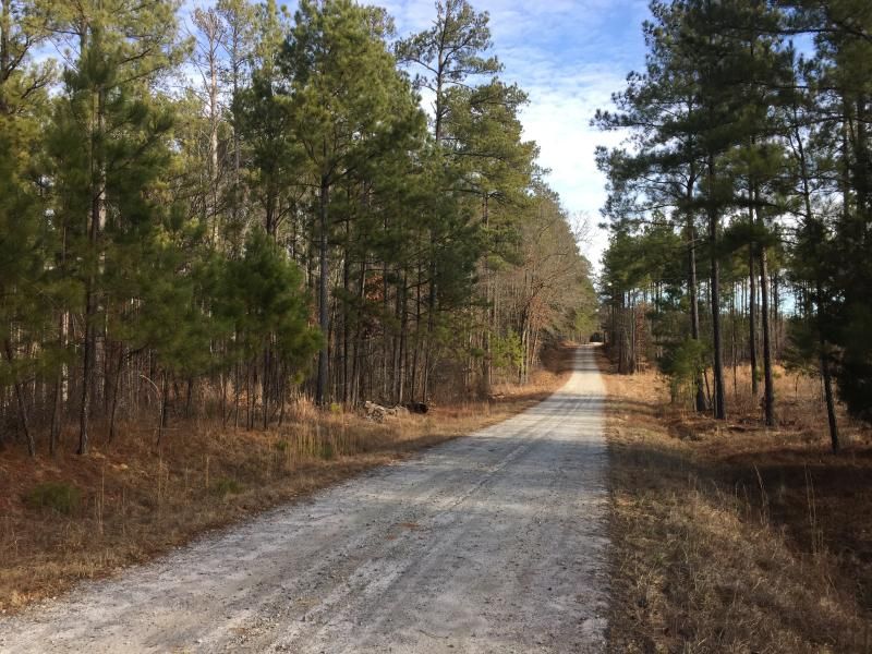 A wee bit flooded. That's ice on top of the "puddle", it was 24*F when we started. 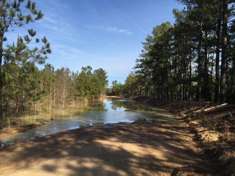 Cooter Pond Road was nice, until this. Big detour was the result. Lame. 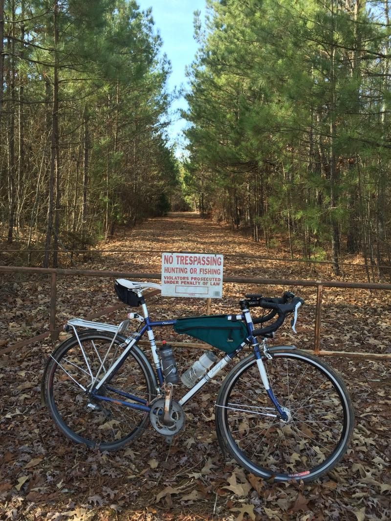 More good dirt. 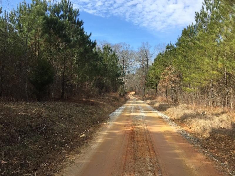 This "road" (FS-6883) is shown on Google Maps as going from HWY-283 south all the way to Price's Mill right at Key Rd. Well, it does, but not exactly. When I turned onto the road I noticed the 'Dead End' sign, but I knew satellite pictures showed the road going all the way through, and I knew it was Forest Service property, so even if part of it was gated off I should be able to continue. Sure enough, part of the way down I hit a gate and the road went from gravel to "woods road", then overgrown woods road (pictured), then not so overgrown woods road (at this point I passed a group of hunters taking a deer stand out of the woods, they seemed very surprised to see me), then a short bit of tight rake and ride singletrack, and then you're back on a gravel road again. Best find of the day!! 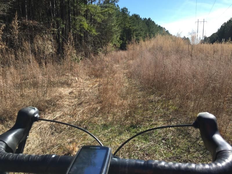 Even though I didn't get the ride I wanted, it was still a good day in the saddle. Weather was perfect. 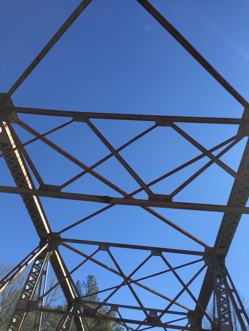 |
|
|
|
Post by dgaddis1 on Jan 27, 2015 8:52:06 GMT -5
Looks like a nice route! That's a fun creek crossing when it's warm and/or when the water is down....was the water up and over the rocks a few yards downstream from where the two roads would connect if they didn't dead end? The road by the field is one of my favorites that I've come across.... Where's the smiley face bridge? Yep, the rocks were all under water. There's also a couple of trees that fell across in that spot, you can almost use them to get across but it looked super sketchy. The bridge is a little ways after the field, when you hit a tee on Iron Bridge Rd you take a left and it's at the bottom of the hill. It's cool! |
|
|
|
Post by dgaddis1 on Jan 26, 2015 8:10:04 GMT -5
Did 40 miles with Ross on Saturday, lots more pavement than we wanted thanks to some unexpected detours and bad Google map information (hint: roads shown with no name, may or may not exist as shown on the map). Still, a few sections of choice dirt, and a good solid 3hrs of turning the cranks. Key bridge, the perfect starting point for most rides in Sumter National Forest. 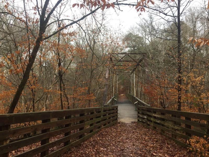 Pretty early in the day we were supposed to cross this creek (which is between two dead ended forest service roads) but it was well over 2ft deep and we didn't feel like getting soaked, so we detoured around it. 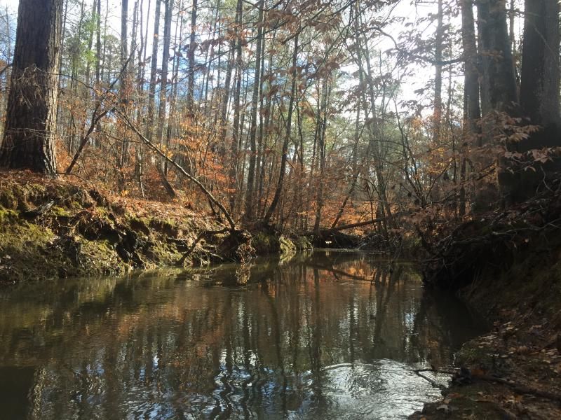 This road rocks. 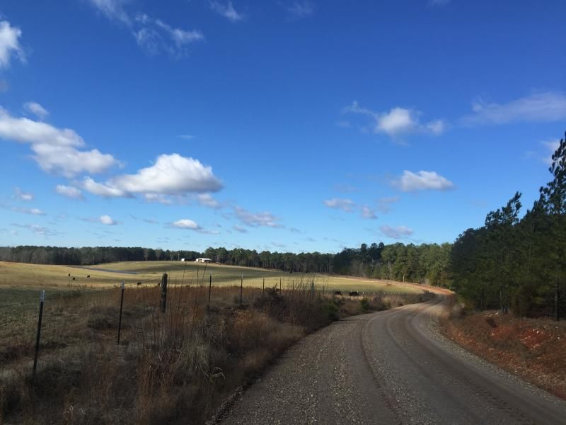 Another cool bridge 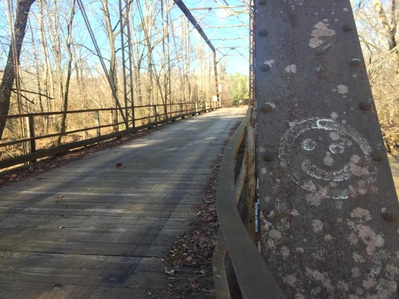 |
|
|
|
Post by dgaddis1 on Jan 22, 2015 22:34:24 GMT -5
I've been helping figure out the course for '15. The bridge on Washington Rd is being removed by GaDOT and is throwing a broom into the front spokes of the race so to speak. But, we've got a route laid out, now it's up to Randy to get it approved by the Corp. of Engineers. Like last year there is some stuff on private land being used to avoid two way traffic on singletrack. The eastern side of the course (Bartram side) is not being changed from last year. But the western side is being modified thanks to the bridge being out. Current GPS route shows 58.2 miles. Actual real life mileage is probably about 60, maybe 62. Mistletoe will be included this year. Keg will be ridden 'backwards' in the CCW direction.
If you wanna train - ride the Thurmond Epic.
|
|
|
|
Post by dgaddis1 on Dec 18, 2014 7:32:46 GMT -5
Keep an eye on the forecast...ride may not go off. Chance of rain is down to 60%, but it's predicted to hit in the morning (grrr). Maybe it'll get pushed back to later in the day...
|
|
|
|
Post by dgaddis1 on Dec 17, 2014 10:25:56 GMT -5
Probably in for this as well! Looks awesome and I've still yet to ride either of these trails! Good! You're in for a treat, this is one of my favorite rides in town. Don't forget to wear orange everyone!! |
|
|
|
Post by dgaddis1 on Dec 16, 2014 12:52:17 GMT -5
I am planning to make this ride. I know the route and will probably be the slowest rider. It may be my 4th ride or so of the last 2ish years. I hope got 25 miles in these legs still. So you may have a good sweeper for this one. Sweet! Wooglin is threatening to come down too. |
|
|
|
Post by dgaddis1 on Dec 16, 2014 8:26:09 GMT -5
Since it tis the season and all that, how about the Christmas Party Ride on Saturday? 10am at the normal Keg Creek Parking lot. 25 miles, plan on ~3hrs total time. If you have never done the Christmas Party Ride: It's a combo of Keg Creek and Mistletoe State Park. Decently long fairly technical (for the CSRA) ride. Lots of creek crossings and other technical features spread out over the 25 mile route. About 8ish miles of the route are road linking the two trails together. Here's directions and a map: sorbacsra.org/Trails/ConnectorRoutes/ChristmasPartyRide.htmEDIT: We'll do this as a no-drop ride. Well, people will probably get dropped a bit here and there, but we'll re-group at turns to make sure no one gets lost. 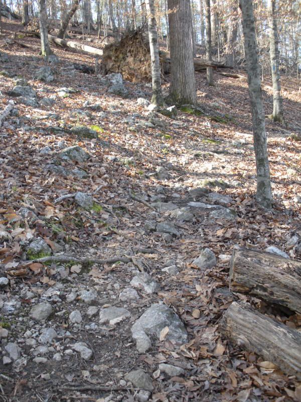 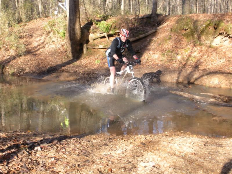 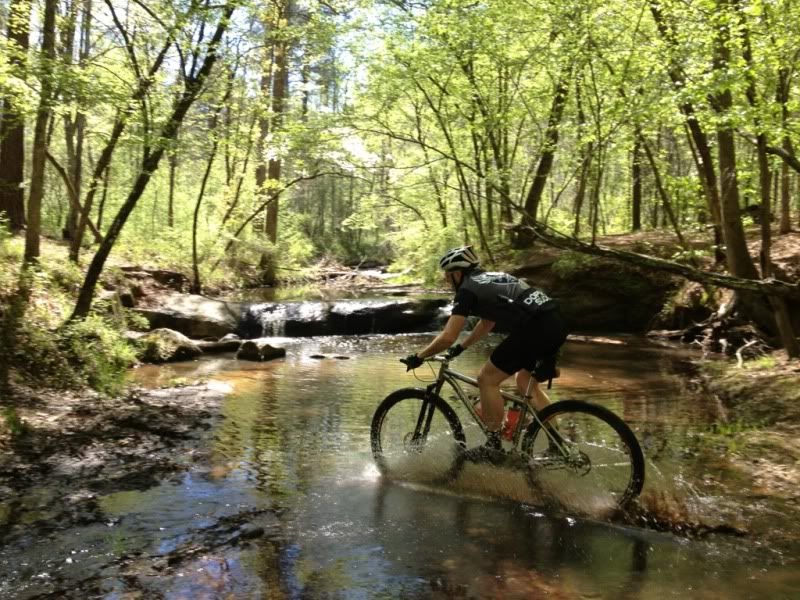 |
|
|
|
Post by dgaddis1 on Dec 14, 2014 10:29:21 GMT -5
|
|
|
|
Post by dgaddis1 on Dec 8, 2014 15:13:21 GMT -5
Excellent question! 9am. Updated the first post with the time also. |
|
|
|
Post by dgaddis1 on Dec 8, 2014 13:21:58 GMT -5
A few of us are doing a long ride on Saturday, this route right here. We'll start at Price's Bottom @ 9am and ride Wine out and back first, pit stop at the cars, then head out on the road to the Modoc trailhead. Modoc, more road, and Turkey back to the car. It's about 42 miles. Pace will be moderate to spirited. Not super fast, but not slow either - I wanna go hard enough to be toast when I roll into the finish. Seeing how little I've ridden lately, that likely wont be all that hard of a pace haha. Bring plenty of food and water, there are no stops along the ~32 mile Modoc/Turkey loop. Also, print out a copy of the directions for the loop ( click here) in case you get separated. Bring your own map and directions, I'm not bringing them for you! This is a big boy & girl ride and everyone is expected to be prepared. Usually we'll regroup every so often on these rides, but if you're significantly faster or slower than the group don't wait on anyone or expect anyone to wait on you. LET ME KNOW IF YOU'RE COMING. Questions? 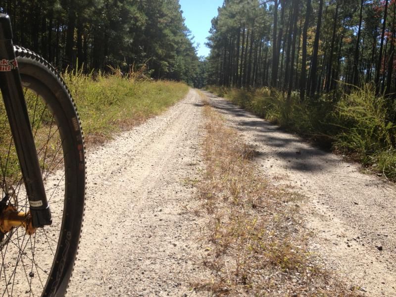 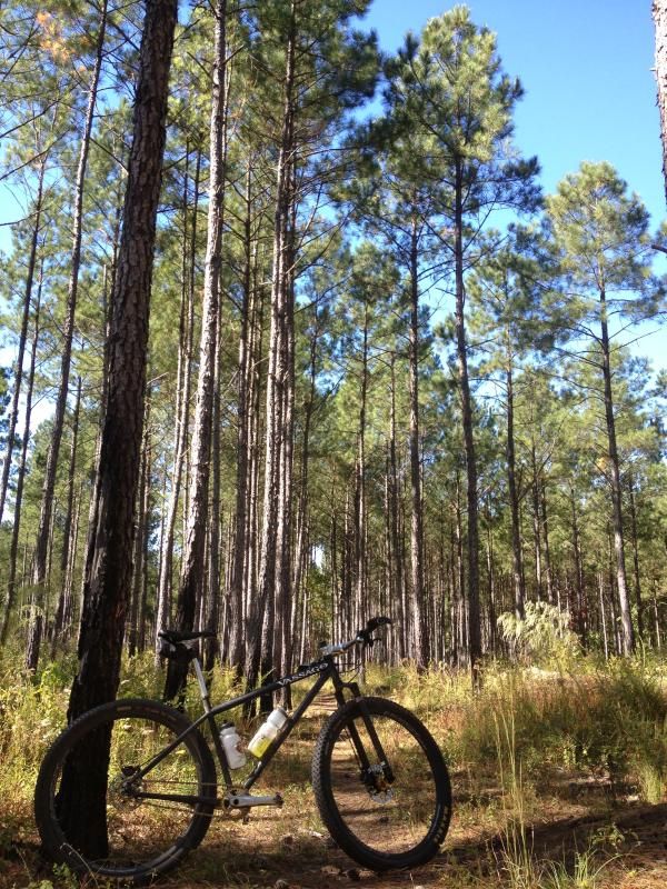 |
|
|
|
Post by dgaddis1 on Nov 17, 2014 11:40:47 GMT -5
Hey everyone. I'm going to overhaul the SORBA-CSRA website soon and would like to update some of the trails and connector routes pages with some new photos. So if you got some you don't mind sharing, you can either post them here or e-mail them to dgaddis12 at gmail dot com.
Things I need to know:
-Who took the photo (should only be you, don't give away someone elses stuff)
-Where the photo was taken (be as specific as you like)
Make sure whoever is in the photo doesn't mind being on the website
Thanks!
|
|