|
|
Post by dgaddis1 on Jan 31, 2014 11:30:55 GMT -5
If you're a Strava user you've probably noticed their new monthly Gran Fondo challenge series. Last month a group of us did GF01 and had a great time, but it was all on pavement. The challenge is the same distance again this month, 130km (81miles), but we're going to mix it up and stay off the pavement as much as possible, sticking to gravel and dirt roads. The route I have mapped out (which may get a few tweaks) is a figure 8, we'll go by the cars about halfway through the route so you can refill bottles. Or, if you're not up for the full 80+ miles you can just do half and call it a day. The route will be somewhere between 81-85 miles, will include about a mile of singletrack, some pavement, lots of dirt/gravel, a little bushwhacking, some interesting scenery, and a few places you'll get wet. It will be an adventure. Some of the non-paved roads are clay, some are dirt, some may have some chunky gravel. You don't want to bring a road bike, but a CX bike would probably be perfect. I don't have a CX bike, so I'll be on a MTB. I'll post the date and the map/cue sheet later. Probably either the 8th or 15th. Just wanted to get word out there so folks can start planning if they want to join in. Everyone is welcome to join in, but it's probably not going to be a no-drop group ride. It will be a ride at your own pace sort of ride. So you'll need a map and cue sheet. I'll post turn-by turn directions, but I can't guarantee they'll be 100% accurate, sometimes the road signs don't match up with the labels on maps. It's gonna be fun. Anyone interested? 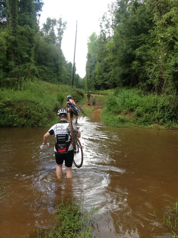 |
|
|
|
Post by kconner on Jan 31, 2014 13:06:38 GMT -5
I'm a definite maybe, most likely for a short route. It'll depend on work schedules, but I'm definitely interested!
|
|
|
|
Post by Catalyst on Jan 31, 2014 13:16:28 GMT -5
I'll do a shorter route with you. Was just emailing dgaddis about riding half of the figure 8 (40 miles) the opposite direction of the main group. It'd be fun to pass everyone somewhere along the way.
|
|
|
|
Post by nitro on Feb 3, 2014 10:10:55 GMT -5
I'll do a shorter route with you. Was just emailing dgaddis about riding half of the figure 8 (40 miles) the opposite direction of the main group. It'd be fun to pass everyone somewhere along the way. I might be up for half also -- keep me updated! |
|
|
|
Post by dgaddis1 on Feb 3, 2014 10:21:57 GMT -5
I'd like to do it this weekend...preferably on Saturday. But the weather forecast doesn't look good right now, so....we'll wait till later in the week to make the call.
Is Saturday or Sunday better for most people?
|
|
|
|
Post by beckyl on Feb 3, 2014 11:21:40 GMT -5
I'd like to do it this weekend...preferably on Saturday. But the weather forecast doesn't look good right now, so....we'll wait till later in the week to make the call. Is Saturday or Sunday better for most people? Either day is fine with us. After giving it some thought, I wouldn't mind doing the half with Catalyst et al. but I know Nevin will want to do the long ride. |
|
|
|
Post by kconner on Feb 3, 2014 12:12:48 GMT -5
I'm working this Saturday, but I'm off on Sunday. I'm off Saturday and Sunday of the following weekend as well.
|
|
|
|
Post by dgaddis1 on Feb 5, 2014 14:51:16 GMT -5
Alright - it's on for Sunday, Feb 9th. Park in the Turkey Creek parking lot down by the pedestrian bridge, on the little gravel road off Key Rd. right next to the bridge (what road is that again??) We'll roll at 9am.It's supposed to rain pretty much all day Saturday, so we're going to just do half the figure 8 I originally had laid out. The other half uses some clay roads that wont be any fun at all this weekend. We'll get them on another ride someday. I'm up for two laps if anyone else is. It's a little over 41 miles. CLICK HERE FOR A MAPPlease print off your own cue sheet/map to bring along for the ride. Put them in ziplock bags to keep them dry and readable. Cue Sheet: Ride approx. 1 mile of the Turkey Creek trail to FS-618. Take FS-618 to Key Rd. LEFT onto Key Rd. 1st LEFT onto Prices Mill Rd RIGHT onto FS-615/Price Rd RIGHT at end of FS-615/Price Rd Immediate LEFT onto FS-613B. Ride to end. Bushwack through woods and across creek to road on other side of creek. Ride road to end. LEFT onto Plumb Branch Rd 1st RIGHT onto Upper Mill Rd RIGHT onto Harmony Rd 1st LEFT onto State Rd S-33-602 1st LEFT onto State Rd S-33-602A Straight across paved road onto Hunters Crossing Rd Ride road to end. LEFT onto State Rd S-33-42 1st LEFT onto Iron Bridge Rd RIGHT at tee onto Christian Rd RIGHT at tee onto E Gold Street LEFT onto Upper Mill/Scott's Ferry Straight onto Windmill Rd RIGHT onto Lewis Lane Stay right at fork on Lewis Lane Straight onto Moton Moore Rd RIGHT onto Sandrock Rd LEFT onto Walker Rd RIGHT onto Wade Morgan Rd LEFT onto Plum Branch Rd RIGHT onto Turkey Rd RIGHT onto Key Rd Return to vehicles. Again, no promise the cue-sheet is 100% accurate. |
|
|
|
Post by eivey on Feb 5, 2014 16:01:24 GMT -5
I'm planning to be there as well. 2 loops depending on weather.
|
|
|
|
Post by Ross D on Feb 5, 2014 18:06:09 GMT -5
I'll sum up my response like this: Kids... UGH.. Basketball, Scouts. Life: Funeral, Heart Ball.. Maybe next time..
|
|
|
|
Post by dsquaredmsquared on Feb 5, 2014 18:51:04 GMT -5
Park in the Turkey Creek parking lot down by the pedestrian bridge, on the little gravel road off Key Rd. right next to the bridge (what road is that again??) Price's Bottom? FS 614 ( goo.gl/maps/DWZMK) |
|
|
|
Post by dtstfunk on Feb 6, 2014 8:58:58 GMT -5
I'm considering it but have finals for a college class this weekend. I'll have to see how far I get on saturday before I can commit.
|
|
|
|
Post by tzeaser on Feb 7, 2014 11:54:26 GMT -5
I don't know how much it's supposed to rain Saturday, but the creek on 613B was not safe to cross a day after heavy rain a few weeks ago. There is a large Beech tree laid across the creek about 100' upstream for the adventurous. WCS - backtrack to the paved road, turn right to Upper Mill, turn right to 283 and pick up your route again.
|
|
|
|
Post by dgaddis1 on Feb 7, 2014 13:08:37 GMT -5
I don't know how much it's supposed to rain Saturday, but the creek on 613B was not safe to cross a day after heavy rain a few weeks ago. There is a large Beech tree laid across the creek about 100' upstream for the adventurous. WCS - backtrack to the paved road, turn right to Upper Mill, turn right to 283 and pick up your route again. Everyone bring an extra pair of socks  Supposedly there's some rocks you can hop across very close by as well. There's another spot on the route where the road itself sometimes floods apparently, but you can walk up on the bank around it. |
|
|
|
Post by Ross D on Feb 7, 2014 20:24:39 GMT -5
I'm gonna do route backwards and meet you guys as I'll go to church, and leave my car riding route backwards hopefully by 11:00..
|
|
|
|
Post by dgaddis1 on Feb 10, 2014 8:17:11 GMT -5
That was a grand time! About 13 people came out and rode. Turns out part of my route was on private property, so some of the group turned around and backtracked back to the beginning, and some of us did a detour to go around the private property. No one did two laps, one was enough. Little of everything, pavement, singletrack, dirt, gravel, mud, and a creek crossing. Here's the loop, with the detour: www.strava.com/activities/112241041 And here's some pics. 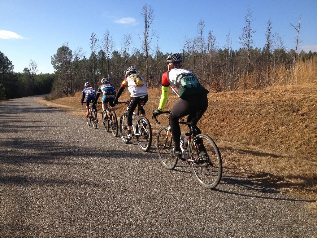 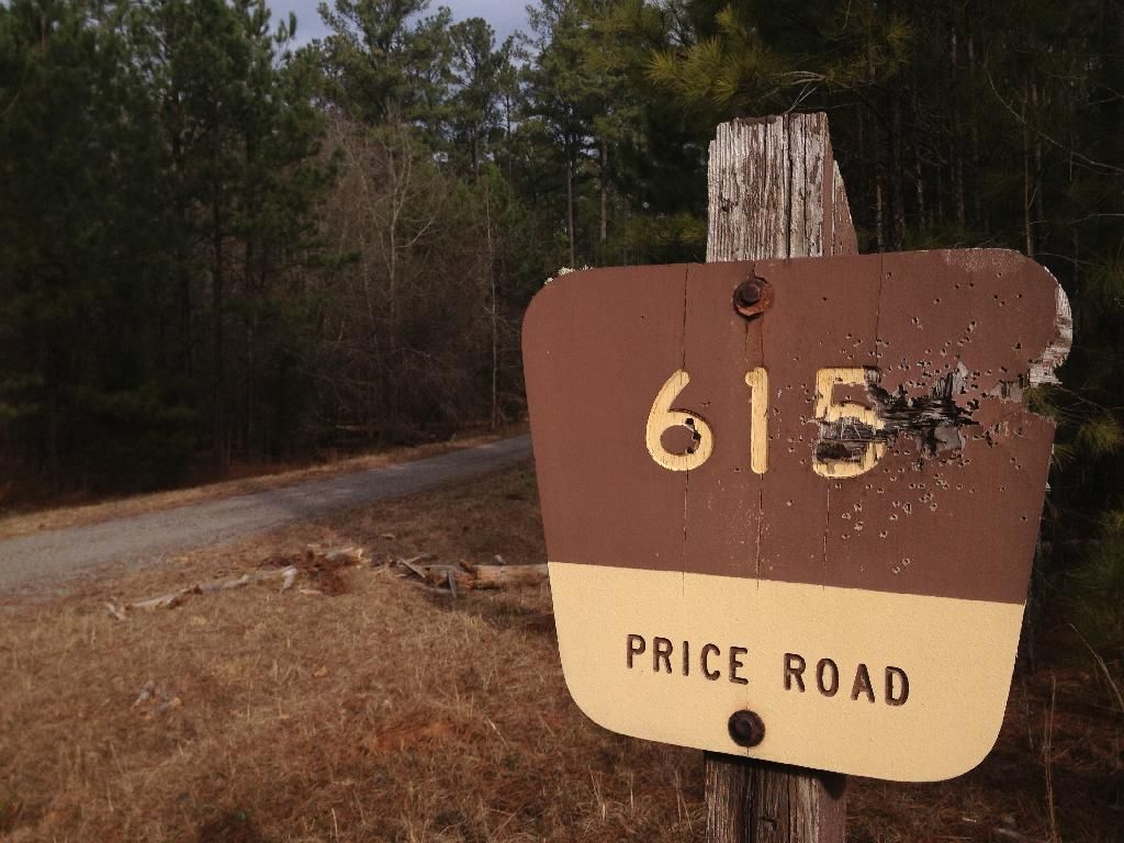  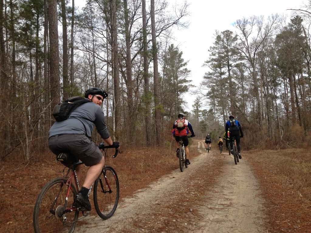 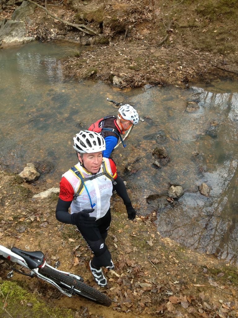 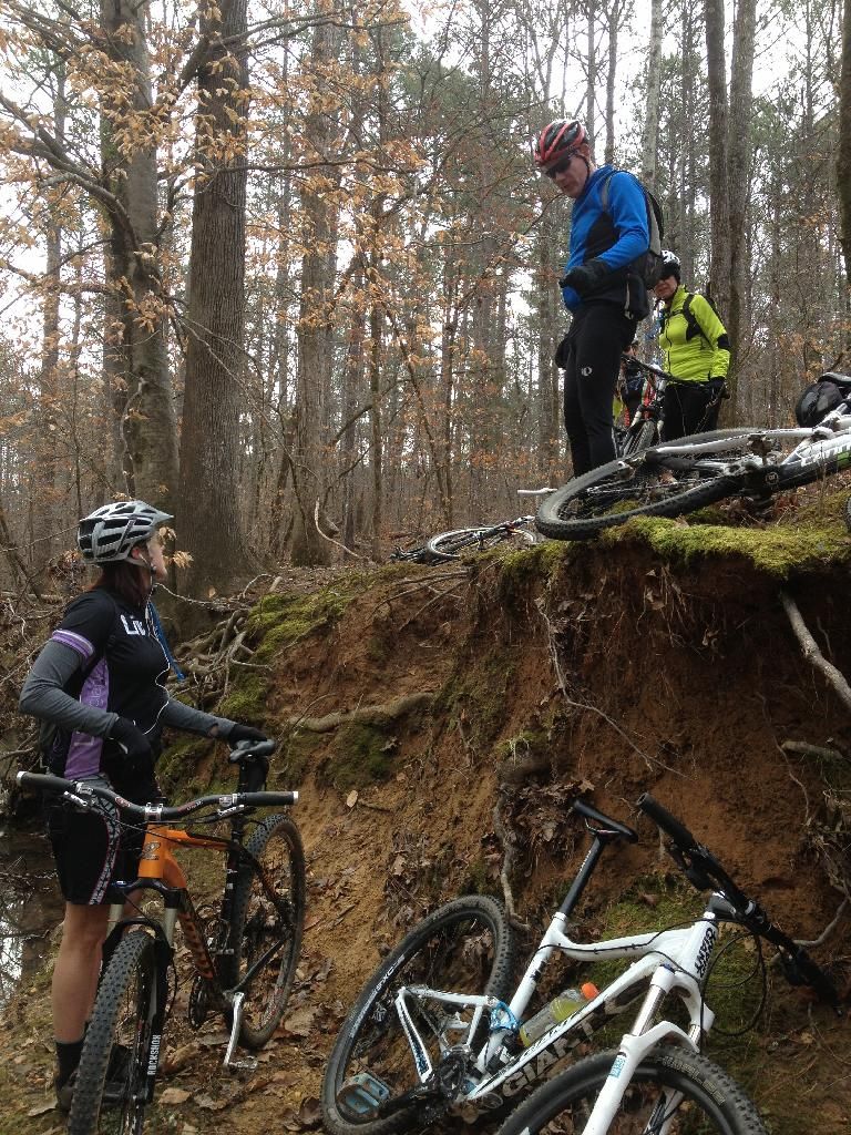 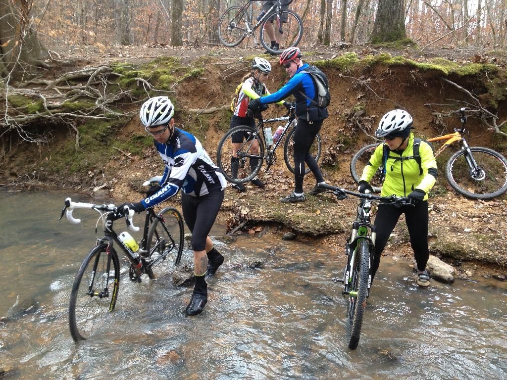 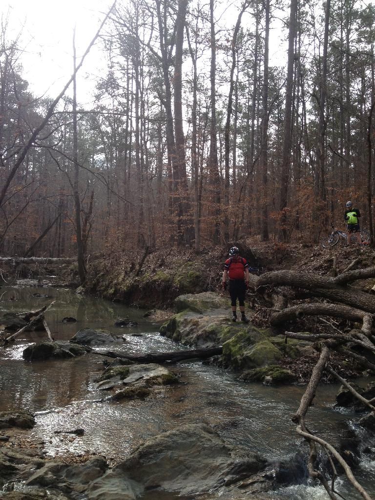 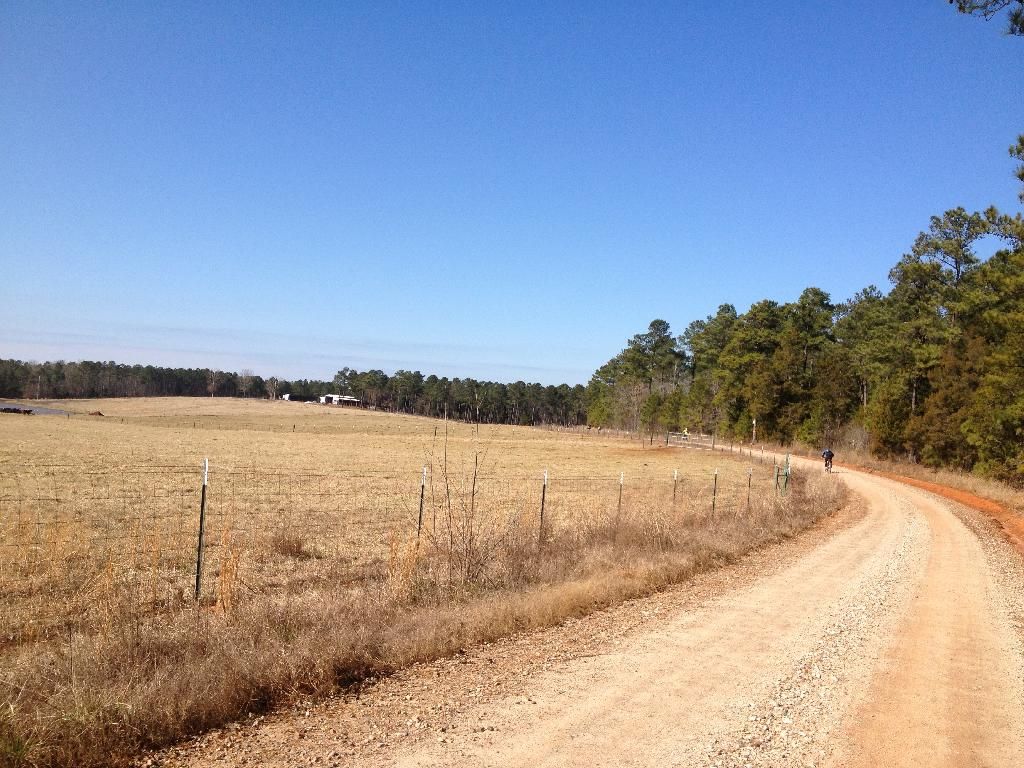 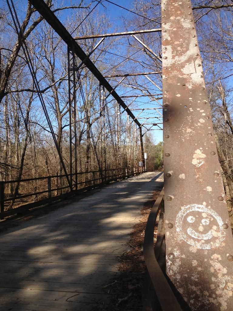 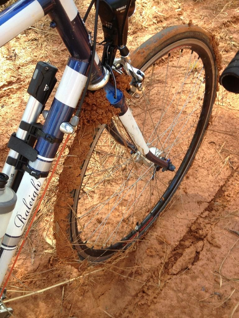 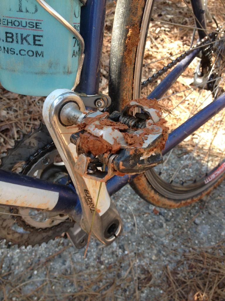 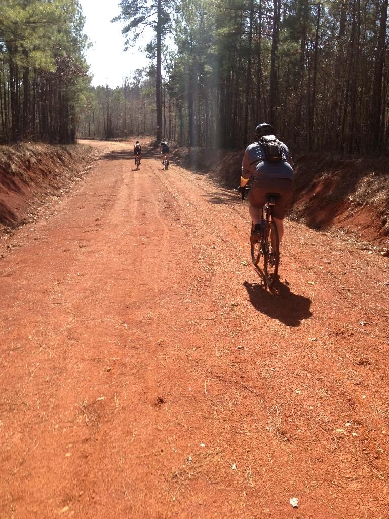 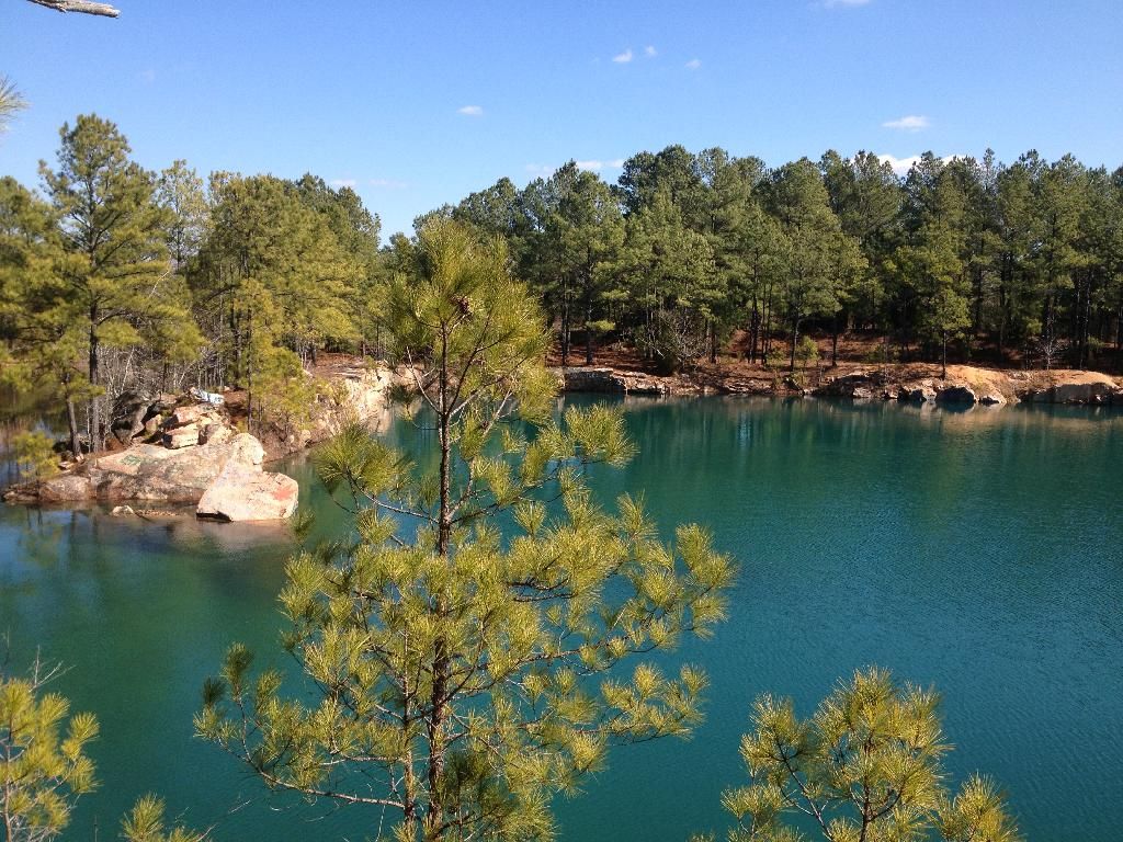 |
|
|
|
Post by dtstfunk on Feb 26, 2014 14:51:48 GMT -5
Looks like I missed February. Hoping March is a better month.
|
|


 Supposedly there's some rocks you can hop across very close by as well.


