|
|
Post by dsquaredmsquared on Jan 13, 2013 15:12:03 GMT -5
PF and I finished putting up the mile and directional markers on Keg Creek. Several non-riders in the back section of the trail. Otherwise, the trail and riders were in great shape. PF with loaded BOB  More pictures here: sorbaCSRA FB page |
|
|
|
Post by brianW on Jan 13, 2013 15:37:46 GMT -5
Are the markers according to just Keg or added on to Bartram?
|
|
|
|
Post by dsquaredmsquared on Jan 13, 2013 16:06:50 GMT -5
Added on to Bartram. The first 3 mile markers put out by Dale and Paul start at 18 or so (across from the end of Bartram) and we continued all the way around, in 0.5 mile increments, until we finished at the Keg parking lot. I'm told this is the way that the ACOE wanted the mile markers labeled.
|
|
|
|
Post by dparrott on Jan 13, 2013 17:58:56 GMT -5
looks great
thanks Paul and Dave
|
|
|
|
Post by jagayers on Jan 14, 2013 10:42:21 GMT -5
That looks like someting out of Death Race.... Don't follow too close.
|
|
swest
Gear Masher

Posts: 13
|
Post by swest on Feb 4, 2013 7:18:39 GMT -5
The two non-rider trees that were down are cleared, as well as quite a few vine-entangled small branches that blocked the trail in several places. Those signs look good!
|
|
|
|
Post by brianW on Feb 11, 2013 19:49:37 GMT -5
non-rider near 21.5 (out by the point) another after boulder creek (ccw) however there are numerous riders. Tread in good shape.
|
|
|
|
Post by dgaddis1 on Apr 13, 2013 15:36:35 GMT -5
Keg is good, creeks have plenty of water, but trail is bone dry. Go get some! 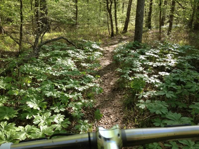 TedS dropping into a creek. Pretty sure this one has gotten a bit steeper with the recent rains. 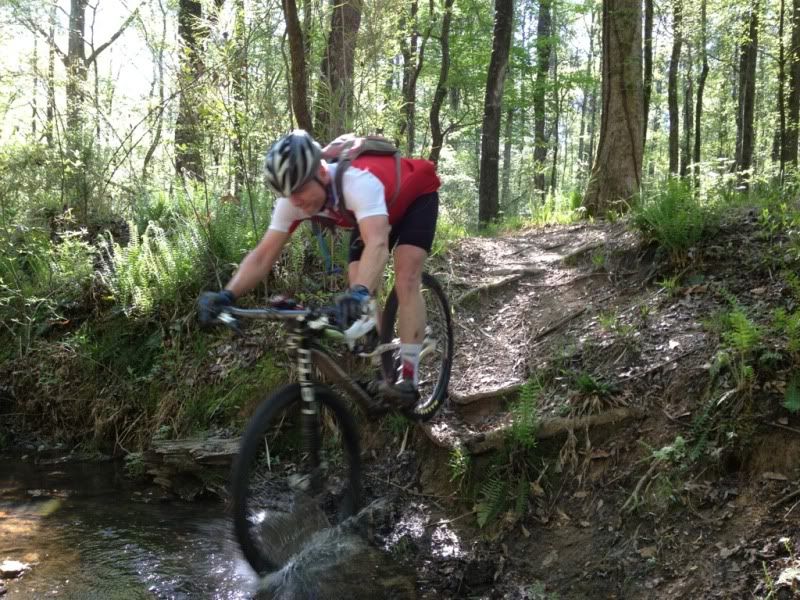 |
|
|
|
Post by dsquaredmsquared on Apr 13, 2013 16:48:25 GMT -5
TedS dropping into a creek. Pretty sure this one has gotten a bit steeper with the recent rains. JP3 figured out the line (with JT's help) to ride up that slope and did it on his first try during our last ride out there - a week or two ago. |
|
|
|
Post by pwest on Apr 27, 2013 10:49:20 GMT -5
Sherri and I walked the dogs out there last night. Couple of observations: a section had been burned (earlier in the day?) and was still smoldering. This was directly across the water from the main parking lot. There was a narrow fire break around the perimeter. One small hotspot up the hill from the trail was still burning and the smoke was very heavy. There were some 4 wheeler tracks past the burned area and I'm guessing that they were from the fire response folks.
We walked for a couple of miles (counter-clockwise)and I'm happy to report that we did not come across any additional fires. Also, we noticed that someone is already messing with the mile markers (the "26" had been removed from the last one.)
We turned around just past the mistletoe spur trail so I can't comment on conditions past that point.
|
|
|
|
Post by kconner on Apr 27, 2013 13:18:01 GMT -5
Sherri and I walked the dogs out there last night. Couple of observations: a section had been burned (earlier in the day?) and was still smoldering. This was directly across the water from the main parking lot. There was a narrow fire break around the perimeter. One small hotspot up the hill from the trail was still burning and the smoke was very heavy. There were some 4 wheeler tracks past the burned area and I'm guessing that they were from the fire response folks. We walked for a couple of miles (counter-clockwise)and I'm happy to report that we did not come across any additional fires. Also, we noticed that someone is already messing with the mile markers (the "26" had been removed from the last one.) We turned around just past the mistletoe spur trail so I can't comment on conditions past that point. There was a woods fire (n |
|
|
|
Post by kconner on Apr 27, 2013 13:21:49 GMT -5
Sherri and I walked the dogs out there last night. Couple of observations: a section had been burned (earlier in the day?) and was still smoldering. This was directly across the water from the main parking lot. There was a narrow fire break around the perimeter. One small hotspot up the hill from the trail was still burning and the smoke was very heavy. There were some 4 wheeler tracks past the burned area and I'm guessing that they were from the fire response folks. We walked for a couple of miles (counter-clockwise)and I'm happy to report that we did not come across any additional fires. Also, we noticed that someone is already messing with the mile markers (the "26" had been removed from the last one.) We turned around just past the mistletoe spur trail so I can't comment on conditions past that point. There was a woods fire (not a prescribed burn) somewhere in that area yesterday afternoon. Not sure what started it, but the local fire department and GA Forestry had a tractor and a couple of woods trucks in the area. As long as any hotspots are in the plowed area, there shouldn't be anything to worry about as far as the fire is concerned. |
|
|
|
Post by dsquaredmsquared on Jul 29, 2013 8:00:23 GMT -5
Something about abandoned bikes and Keg Creek. Another bike on Keg Creek.  |
|
|
|
Post by dgaddis1 on Jul 29, 2013 9:56:05 GMT -5
There's a lot of spokes in those wheels.
|
|
troy
Gear Masher
Posts: 29 
|
Post by troy on Dec 25, 2013 16:25:24 GMT -5
Rode most of Keg Creek today and it is in really good condition. Good trail to ride with FATS being so wet.
|
|